Integrative approaches to climate adaptation in the Braunschweig region
By Franziska Günther and Hubertus von Dressler
Extreme hydrological situations have gained significant momentum in recent years. This has been particularly noticeable in the region of Greater Braunschweig.

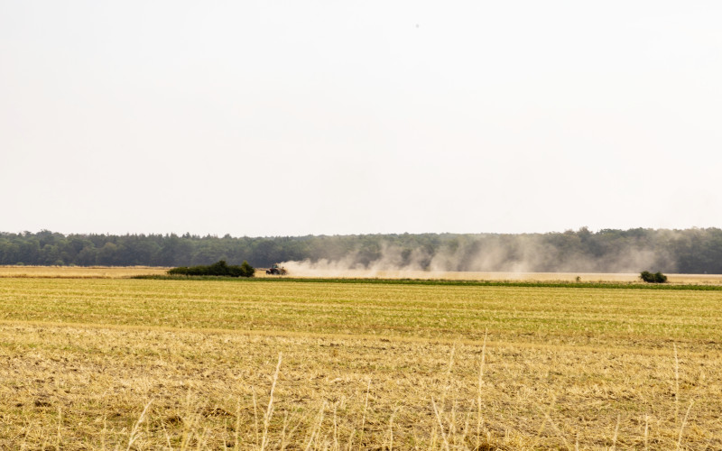
For example, 2017 was characterized by widespread river flooding on the Oker and Innerste rivers in the Wolfenbüttel district (Wasserverband Peine (WV Peine) 2018). In contrast, the following years 2018, 2019, 2020, and 2022 were characterized by an exceptional drought and intensified, among other things, the large-scale forest damage in the Harz Mountains.
The dry years also led to persistent low water levels in the Harz reservoirs and an increasingly tense situation in the drinking water supply (Harzwasserwerke GmbH 10.09.20209). The region's arable farmers were equally hard hit. Agriculture in the southern heath in the north of the region, which is almost entirely dependent on field irrigation across all crops, required around 1.5 times more water than was authorized in the very first year of drought in 2018 (Kehlert 2019). In 2022, the lack of water led, among other things, to the drying out of a section of the Aller River with catastrophic consequences for aquatic life (Westdeutsche Allgemeine Zeitung 05.08.2022).
The drought will come again and requires a rethink from all of us. The drought shows us that sensible and moderate water use must be discussed by society as a whole. All those involved in the water cycle must work together on solutions for the future and find a balance to ease the competitive situation for water as a resource. We do not want a fight for water, but the discussion about who gets how much water in the future is unavoidable.
Christoph Donner, 10.09.2020
The impacts of climate change affect the various land use sectors equally, and integrated approaches are needed accordingly to realign the relationship between land use and landscape water balance. The Integrated River Basin Partnership Northern Harz Foothills in the Greater Braunschweig region is a pioneering example nationwide.
There is only ONE water landscape
The Integrated River Basin Management Northern Harz Foreland follows this simple premise and is the first inter-municipal and inter-sectoral cooperation in Lower Saxony to focus on holistic water body and flood protection. The cooperation, which emerged as a project from the ILE region Nördliches Harzvorland, has recognized that an isolated and locally limited consideration of flood protection is not expedient. Rather, the previously rather separately considered topics of the water balance (such as flood protection, water use and watercourse development) are interlinked to find sustainable, efficient and land-saving solutions.
"Our strength is our communication"
With a good communication strategy and the establishment of a stable network, as described by Andreas Memmert in the quote above, it has been possible to break down prejudices at an early stage and in a targeted manner, to sound out common interests between the various land users and ultimately to implement projects together.
While the cooperation community focused primarily on flood protection in its beginnings in 2009/10, the topics soon expanded to include watercourse, floodplain and biotope development. The cooperation was then continued as Integrated Watercourse and Floodplain Management and finally resulted in the current Integrated River Basin Management. This deals with the entire water balance and tests, for example, the restoration of natural water reservoirs and the stabilization of groundwater levels through natural water retention measures.
The proportional rewetting of a former fen is one of the current measures. The step-by-step approach is decisive for the success of the initiative, as continuous implementation and awareness-raising have enabled a high level of trust to be built up among the stakeholders. River basin management therefore also sees itself as part of a continuous improvement process.

The tools of the river basin partnership
The core of the river basin partnership is the integrated flood protection concept, which describes the operational objectives and a catalog of around 150 prioritized adaptation and prevention measures. The implementation of the projects as well as the updating of the concept take place on the operative level, which is filled by two working groups (one each for the two working areas Oker and Innerste) as well as the project sponsors. A regular analysis and review of the achievement of objectives is ensured by the strategic level in the form of a steering committee. In addition to the acquisition of funds, the availability of land is a decisive factor for the successful implementation of the project. For this reason, a land management tool is also being developed in parallel.
A county is now turning blue
Based on the successes of the river basin partnership, further flood partnerships have been initiated since 2016. The district of Wolfenbüttel in the greater Braunschweig region was also inspired by this and has been driving the "Blueing Strategy" since 2022. It relates to the entire catchment area of the water bodies - the Börden region, which is strongly characterized by agriculture. Here, the natural processes of the water cycles have been fundamentally altered. "Blueing" starts here. New vegetation systems that promote cooling, water retention and small-scale water cycle closure through evaporation, condensation, infiltration and uptake by plants play the central role in shaping the landscape, along with other "Blueing" building blocks.
A first project has already been launched in the form of an agroforestry in Lucklum. Further projects, which the district is preparing in close cooperation with the various land users, are to follow. The "Blueing" concept and the associated slogan "Einfach-Blau-Machen" were developed as part of Ina Küddelsmann's dissertation, which is still in progress, and are based, among other things, on the ecosystem process understanding of Professor Dr. Wilhelm Ripl. "Blueing" is thus synchronous climate, biodiversity, soil, flood and water protection.
Integrated landscape approach as a future strategy
Hydrological impacts from climatic changes are encouraging new approaches to landscape management and breaking down long-standing fronts. One-sided optimizations in favor of dominant land use are being overcome in the face of existing challenges through multifunctional design of our landscapes. Common goal and assessment frameworks and co-creative participation form the central elements of an integrated landscape approach to sustainable spatial development. In this context, the presented initiatives act as pioneers, encouraging us how to cope with the upcoming change processes.
Sources:
- Küddelsmann, Ina (2022): "Blueing": moving more successfully towards
- sustainability. From "red" to "blue" land uses, value networks and lifestyles. A water-oriented, connecting concept with benefits and potentials for planning, governance and self-organization towards climate, nature and society stabilization (working title). Ongoing dissertation.
- Memmert, Andreas (08.12.2022): "Our strength is our communication". Available online at: https://www.wolfen-buettel.de/Sonstiges/Startseite/ILE-Lenkungsgruppe-trifft-sich-die-Förderperiode-läuft-aus.php? object=tx,3413.5undamp;ModID=7undamp;FID=3413.6910.1
- Donner, Christoph (10.09.2020): Harz water works prepare for double dry year again. Available online at: https://www.harzwasserwerke.de/presse/pressemitteilun-gen/2020/harzwasserwerke-bereiten-sich-erneut-auf-doppeltrockenjahr-vor/
Author:inside: Franziska Günther, Wiss. Mitarbeiterin im E E-Project "Regionale Grüne Infrastruktur in Stadtregionen" gefördert durch das BfN mit Mittel des BMUV und Prof. Hubertus von Dressler, Landschaftsplanung, Landschaftspflege, Fakultät Agrarwissenschaften und Landschaftsarchitektur, Hochschule Osnabrück. The text was published in the bdla association journal "Landschaftsarchitekten" 1/2023.
Read all articles of the thematic focus "Water Strategies" of the bdla association journal:
- Latitude: 0
- Longitude: 0


