Transformation process in our landscapes - understanding future-oriented spatial development.
By Hubertus von Dressler, Henrik Schultz, Lasse Höppner, Paula Hübner, Simon Oberbarnscheidt
News
By Hubertus von Dressler, Henrik Schultz, Lasse Höppner, Paula Hübner, Simon Oberbarnscheidt
The current changes to the landscape and rural areas in particular as a result of the energy transition and the restructuring of infrastructure are serious. In the corresponding planning and approval processes, it is becoming increasingly difficult to quickly initiate the necessary transformations in terms of sustainable, future-oriented spatial development.
New approaches are needed to accompany and significantly shape this transformation process in our landscapes (see bdla position "Shaping change"). This should be a central task of landscape planning - but so far it has hardly lived up to this claim, as it is still seen more as an analytical rather than a planning instrument. Experts tend to discuss legal issues or their planning symbols rather than integrated approaches to solutions and concrete future images of climate-resilient, identity-creating landscapes.
Landscape planning must exploit the potential for successful communication inherent in such images in particular.
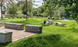
This is because, unlike in object and open space planning, it is not about the design of an area, but of landscape as a space that we share with each other and whose future appearance we have to agree with each other in the field of tension between private rights of disposal and social interests.
Spatial images show the landscape as a whole and integrate ideas for its transformation. The co-creative work on the spatial image can be described as a game of highlighting and omitting.
For example, if the stakeholder group agrees that in the context of flood events and biodiversity conservation, more weight should be given to floodplains in the transformation, the river's floodplain is highlighted instead of the line of the river that is barely visible on the topographical map and its connections to the surrounding landscape are graphically emphasized. The floodplain thus appears as a defining component of the landscape, in some places as a boundary for settlements, in others as a mandate to promote land swaps with farmers in order to replace arable land with grassland.
Only when the floodplain appears before everyone's eyes in the draft spatial image can it be discussed whether its influence on the future transformation is exaggerated, not powerful enough or just right. In order to create a spatial image that different stakeholders see and use as their image, negotiation processes are needed in which the expertise of the experts designing the image and the knowledge of the local stakeholders are incorporated.
If the interplay between professional image production and professional process design is successful, spatial images can have an impact as a central part of formative landscape planning. They are then a means of communication for negotiating the question "What kind of landscape do we want to live in in the future?"
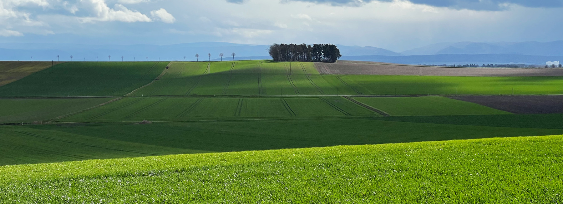
A sustainable, resilient landscape transformation is also a challenge for the district of Wolfenbüttel in south-eastern Lower Saxony. A project in the "Landscape Architecture" Master's course at Osnabrück University of Applied Sciences has developed spatial images for this agriculturally dominated region.
The "Landscape Theater" aims to boldly design landscapes that are already undergoing change, while sensitively incorporating their special features and sensitivities. This requires a well-founded understanding of space, which is created through an interplay between external and internal views. In particular, movement in the landscape and the accompanying sketching form the basis for an iterative design process: observe - understand - develop - test - apply.
In the project, concise elements and recurring, typical landscape views were initially identified. The elements appear as main and supporting actors in the landscape through changing intensities. In addition, scenery elements as well as stages and grandstands can be recognized. This overall landscape ensemble gives rise to theatrical scenarios that help to illustrate and understand the interplay of the "actors" and thus facilitate landscape communication: Which transformational approaches fit the pace and shape of a landscape?
In the theater motif, stage sets can be changed, further developed and possible transformation approaches can be playfully tested through intensive sketching. The characteristic views of the landscape act as a yardstick for an appropriate transformation in the design process.
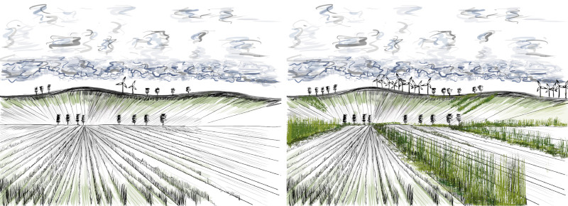
Future scenarios are created (see illustration above) in which dynamics are changed by adding and arranging (new construction) or reinforcing (spin-off) the "actors" and landscape potentials are revealed. For example, the Oker river with its continuous floodplain takes on a new leading role and combines biodiversity, flood protection and local recreation. On the other hand, parts of the landscape that are worth protecting or already resilient are preserved as evergreens and form a counterpoint to areas undergoing rapid transformation (see illustration below).

For the further transformation process in the district of Wolfenbüttel, the "Landscape Theater" (see illustration below), together with five other spatial images that were developed and presented on site in the "Kulturhaus Dettum" gallery, initially functioned as external input for ideas.
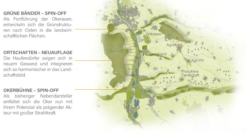
The discussion led by the regional key players about which specific talents of the region were emphasized, which images create new perspectives for the region and which ideas are particularly convincing, forms the entry into the further joint communication and implementation process.
The spatial images show that a careful approach to our landscape qualities and a bold look into the future belong together.
Sven Volkers
District Planning Officer Wolfenbüttel
Inspired by the projects, district planning officer Sven Volkers now wants to continue working with the spatial images. "They have inspired us to continue shaping the landscape together with the various stakeholders."
With the spatial images as a tool and an open and creative way of working, creative landscape planning can better communicate complex relationships. A consensual understanding of space can thus be the framework for implementing strategies and concrete projects for the diverse spatial challenges more effectively than before.
Authors
Prof. Hubertus von Dressler, member of the bdla, Faculty of Agricultural Sciences and Landscape Architecture, Osnabrück University of Applied Sciences.
Prof. Dr. Henrik Schultz, landscape architect bdla, DASL, Faculty of Agricultural Sciences and Landscape Architecture, Osnabrück University of Applied Sciences, project focus. Supervisor Landscape Architecture Summer semester 2023. Osnabrück University of Applied Sciences.
Lasse Höppner, Paula Hübner, Simon Oberbarnscheidt, Master's course in Landscape Architecture. Summer semester 2023, Osnabrück University of Applied Sciences.
The text appeared in the bdla association magazine "Landschaftsarchitekt:innen" 1/2024.

Germany offers great opportunities for your career as a landscape architect.
Landschaftsarchitektur-heute.de presents more than 3000 projects of 600 planning offices.
Landscape Architecture
Announcements
Association