Munich, 27 April 2020 - Dr. Johannes Gnädinger, member of the board of bdla Bavaria and head of the landscape development working group, will report on the current status of the planned model project.
The current members of the working group are Marion Linke, Dietmar Narr, Stephan Pauleit, Markus Reinke, Gudrun Rentsch, Andreas Rockinger and Barbara Weihs.
Introduction
In 2019, the bdla Landesverband Bayern launched an initiative to modernise and further develop the municipal landscape plan. This came, in the course of the popular initiative "Save the Bees" as well as the "Fridays for Future", exactly at the right time, so that the Bavarian Minister of the Environment Thorsten Glauber immediately took up the project at the end of 2019 to bring forward a model project.
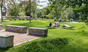
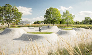
The landscape plan is considered by our profession to be a central instrument - an overall concept that balances the interests of use in the municipal area, anticipating the ecological and cultural landscape quality as well as the long-term protection of resources. Although such integrated approaches are of paramount interest today, the landscape plan has in the meantime, with the exception of the larger towns and cities, lost a great deal of its importance. Only 55 Bavarian municipalities have a landscape plan at all and most of them are already out of date.
With the requirement for municipal landscape planning in the law (BNatSchG §11, 2 (2); BayNatSchG Art. 4, 2 (2)) there is no general obligation to draw up a landscape plan, but a necessity is required. However, this will usually be the case because increased challenges in nature conservation and environmental protection - in particular the protection of biodiversity, climate protection/adaptation, urgent water protection, soil protection including reduction of land consumption, the strong landscape change or the participation to be intensified - require interdisciplinary coordinated concepts of a high standard.
The conventional landscape plan methodology now clearly takes too little account of the major future issues. The contents of landscape planning must therefore be redefined, the methodological approaches reviewed and further developed. The experts are particularly called upon to do this.
In addition, the significance of the landscape plan and thus its observance, application and implementation in the municipalities must be greatly improved. This task is primarily in the hands of the politicians at the various levels as well as within and between the departments concerned (above all environment, agriculture and forestry, construction and transport, energy, economy).
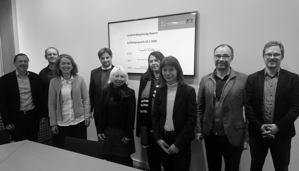
Kick-off meeting "Landscape Plan reset" at the State Ministry for the Environment and Consumer Protection in January 2020. From left to right: Claus Hensold (LfU), Dr. Johannes Gnädinger (bdla), Christine Danner (LfU), Christoph Stein (StMUV), Evelin Köstler (ANL), Marion Linke (bdla), Martina Robitsch (StMUV), Andreas Rockinger (bdla), Paul-Bastian Nagel (ANL). Not in the picture: Ulrike Lorenz (StMUV). Photo: Paul-Bastian Nagel.
Aim of the model project
The aim of the model project is thus the further development and testing of the methodology of the landscape plan instrument and the promotion of a broader application and practical implementation in the Bavarian municipalities. The bdla as well as the professional and political institutions at federal and state level, model projects and R E projects, have developed contributions and methods in the past years so that many suggestions for a contemporary landscape plan will be available. At this point we expressly ask for suggestions from the readers!
When selecting example municipalities, different spatial types should be taken into account which reflect different landscape cultural and economic conditions or also factors such as accessibility, demographic growth or shrinkage. The following spatial types are conceivable: metropolitan urban landscapes, suburban intermediate landscapes, rural and small-town landscape networks and sparsely populated landscapes.
These space types should also be taken into account in the further development of planning methodology, as uses (e.g. agriculture, recreation, nature conservation) face different challenges depending on the space type.
Urban Nature Master Plan
The project is closely related to measures of the "Masterplan Stadtnatur" (BMU, 01.06.2019), which states, among other things:
"We will strengthen municipal landscape planning".
"... Landscape planning must be understood as a process that also has the potential to incorporate informal concepts. (...)"
"We will strengthen landscape planning as an instrument for solving important future tasks with an initiative to amend the Federal Nature Conservation Act."
"... Therefore, in addition to a concretisation of the updating obligation at the landscape framework planning level, the legislative initiative includes a regular review of the updating requirement for landscape planning at the local authority level by the planning authorities ... "
How these measures are to be implemented in concrete terms and whether there are offers for cooperation and support of the model project landscape plan reset by the Federal Environment Ministry still has to be clarified.
Focal points of further development
The following focal points in terms of content and strategy were proposed by the working group for discussion and are now included in the ministerial submission:
Landscape plan and land use plan should - as in the actual urban land use planning - also be processed in a coupled manner in the model project. The land use plan, similar to the landscape plan, is also in a situation in need of improvement. The bdla regional group has already held talks on this with the Bavarian Ministry of Construction, which intends to coordinate this with the Ministry of the Environment - and vice versa.
The core of the project is the further development of the methodology, presentation and communication of landscape plans. Qualitative statements are often at a disadvantage compared to quantitative methods ("hard facts"). Therefore, ecosystem services (ESL) are also considered as quantifying, partly also monetarising approaches.
In particular, the methods of the individual work steps or service phases are to be analysed.
For a needs-oriented work programme, a "phase zero" should be provided for orientation in order to adjust objectives and contents to the concrete local situation, and to determine focal topics and formats.
Participation procedures and the communication of landscape planning should also be investigated. In the course of digitalisation (cf. Building Information Modelling, BIM), generally accessible information and participation platforms should be considered, as well as modern plan symbols (completed R & D project of the BfN), the GIS standard X-planning, online tools, but also the development of future images with sketches, collages or videos, i.e. means of expression of landscape architecture which have hardly been used in landscape planning so far.
The landscape plan should not be understood as a static plan but as a process-related instrument: as a participation concept as well as a dynamic "digital twin" which depicts the environmental status regularly updated, thus also serves as an environmental information instrument and outlines the development objectives.
The utilisation of funding from various departments (nature conservation, agri-environmental measures, rural development, urban development funding etc.) should require the existence of an up-to-date landscape plan - with action programme and catalogue of measures. The landscape plan should therefore become a funding requirement, because in this way the funding would be applied in a "planned" and optimally coordinated manner in the community development.
On the question of the fee
Despite this seemingly important task of renewing and supplementing the methods and building blocks, the offices will also have to deal with the fee for additional services. Already the HOAI basic services lie with the landscape plan frequently at the border to the economy, if in the lower fee zones is to be offered. It must be examined what is feasible under the given financial framework conditions, what can be demanded within the framework of the basic services and what goes beyond these. In any case, intensive interdepartmental coordination would be the right means to upgrade the landscape plan as an interdisciplinary instrument for environmental protection and for balancing land use claims and thus to achieve a broader financial allocation.
Outlook
The working group - together with the State Office for the Environment and with the Academy for Nature Conservation and Landscape Management - is now supporting the Bavarian Environment Ministry in the development of the model project. It has also been able to win over the municipal umbrella organisations as further partners. In the course of the project, which is planned for the next three years, the guidelines are to be developed and then tested in model communities that have yet to be acquired. The prerequisite, however, is that the currently changing budget situation allows this.
Addendum 3 June 2020: The ministerial submission for the model project "Landscape plan reset" is to be completed by mid-June. It will then be up to Minister Thorsten Glauber to adopt the proposals contained therein, i.e. in particular to approve the use of the double budget for the project and to set up the working group accompanying the project. As things stand at present, the latter could then presumably start work before the summer break.
- Latitude: 0
- Longitude: 0